Blackrock Waterfowl Management Area
Flooded acreage monitoring dashboard
Sentinel-2 · BWMA · Owens Valley
Blackrock Waterfowl Management Area
Monthly flooded acreage monitoring · Inyo County, California
Latest flooded
3.1
ac
Aug 2026 · 15-day composite
Month-over-month change
0.3
ac change
-0.3 ac vs prior month
Season peak
716.8
ac
in Feb 2026
Nov–Mar · 500 ac target
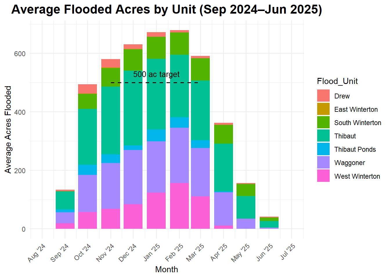
Monthly flooded acreage by unit
Stacked totals by flood unit. Dashed line marks the 500 ac seasonal target (Nov-Mar).
Monthly report archive
Each cell links to that month’s archived report. The day number is the file label date (first scene in the collection)—not a single-scene acquisition. Since April 2026, reports follow the composite workflow below; older entries may reflect ad-hoc run dates and fewer scenes in the window.
Click a day number to open the HTML report (unit table, map, downloads).
Composite workflow (Apr 2026 onward):
Run mid-month with start date
Earlier archive (before Apr 2026): The script always built a median composite, but reports were often run on ad-hoc dates when a clear scene was available—sometimes with only one pass in the window. Legacy report pages may say “imagery date”; that label is the filename date, not proof of a single scene.
YYYY-MM-01. All qualifying Sentinel-2 scenes in the 15-day window are cloud-masked and combined into a median composite; acreage uses NIR on that composite (threshold 0.14).
Earlier archive (before Apr 2026): The script always built a median composite, but reports were often run on ad-hoc dates when a clear scene was available—sometimes with only one pass in the window. Legacy report pages may say “imagery date”; that label is the filename date, not proof of a single scene.